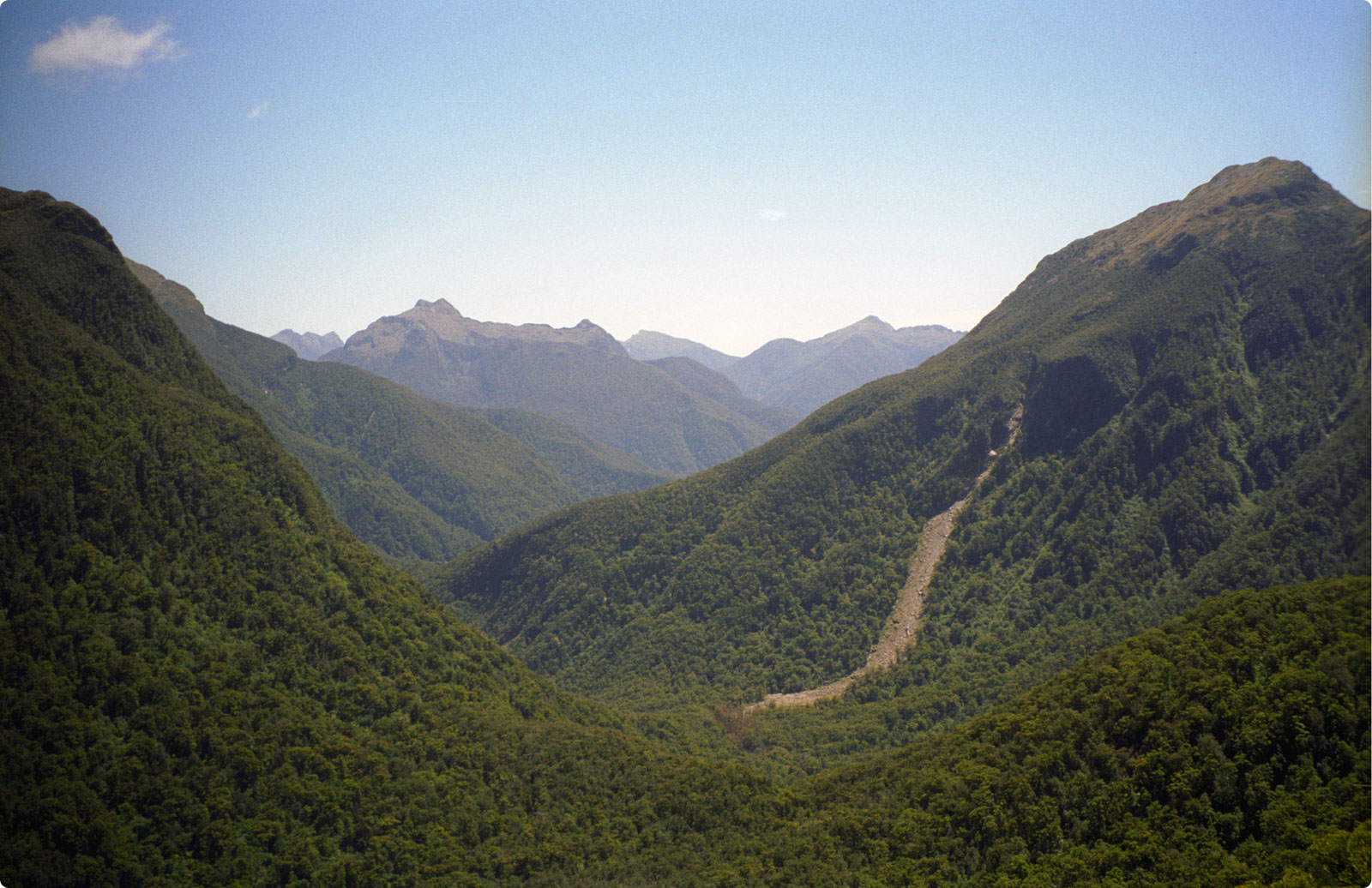
This isn't exactly on top of Henry
Pass, rather it is a bit downhill
from the top. The winds were so strong on the pass, that I
didn't
want to take a picture from there. I had to descend slightly
to
get out of the winds before I stopped to take a picture. Once
I
got out of the wind, it was back to being a perfect, beautiful
day. The track drops sharply to the
left (over the waterfall I describe in
the text) and then follows the left side of the valley before going
over to the right side.
The track crosses the slip that you
see
here. At the bottom, the slip is 60-70 meters wide.
Knowing
its width, look at how far up the mountain it reaches. You
can't
actually see the top of it as it goes behind a ridge in this
picture. It looks fairly smooth from here, but there are
massive
boulders that fell from the mountain. After the
slip, the track follows the valley left and then right around the ridge
at the center of the picture. It is past the ridge that
Katherine
Creek begins and I would follow it all the way to the sea.